
Waimea Canyon’s Breathtaking Views
Although Kauaʻi is only thirty-three miles long at its widest point, the Garden Isle is about as stunning as it comes. You’ll find tropical rainforests along the North Shore, endless palm trees on the Coconut Coast (the East Side), and the arid West Side is home to the one-and-only Waimea Canyon.
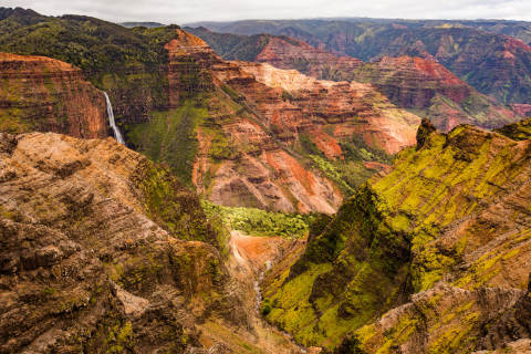
Coined the “Grand Canyon of the Pacific,” Waimea Canyon was formed by its namesake river and holds court as one of Hawaiʻi’s geological treasures. From various lookouts, you’re in for a scenic treat and it’s completely free to visit.
Waimea Canyon Lookout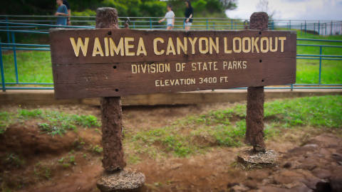
Waimea Canyon Lookout is just past mile marker 10 on Highway 550. The lookout is always busy, but there’s plenty of parking and washrooms. The view from here highlights the rich red and brown stratigraphic layers of the canyon. Watch for tropical birds soaring and if you listen closely, you might hear the bleating of wild goats as they navigate the canyon’s sheer cliff faces.
Puʻu Hinahina Lookout
Further along the highway at mile marker 13 is the Puʻu Hinahina Lookout, one of the best vantage points for taking in Waimea Canyon. This smaller perch offers a straight shot down the canyon with a distant view of Waipoʻo Falls. Hidden behind the parking area's restroom is a short trail leading to a platform overlooking the ocean — on clear days, you can spot Niʻihau, the Forbidden Island, in the distance.

Hiking Waimea Canyon
Casual and seasoned hikers alike will love Waimea and Kokeʻe State Parks for their range of trails.
The 3.5-mile round-trip Waimea Canyon Trail is the most popular of the canyon hikes. Best suited for moderate hikers, it ends at Kumuwela Lookout where you can gaze straight down the canyon all the way to the ocean. About halfway along the trail, you'll catch a view of Waipoʻo Falls and its two tiers of cascading water. You can also hike to the base or top of the Falls for another five miles there and back.
For an easier outing, the Cliff Trail is a 1.8-mile round trip that leads to a beautiful lookout. Start at the Halemanu Trailhead off Kōkeʻe Road.
Weather Note: Double-check hiking conditions at the Koke’e Natural History Museum before you head out; they’ll have trail maps and info on current weather watch-outs. If you can, plan your visit and hike for a sunny day — some trails can get slippery, with steep inclines and the occasional tree root to watch out for. Sometimes, the canyon will be shrouded in mist but we still think it’s pretty magical.

Kalalau Valley
After soaking in Waimea Canyon, keep driving until you reach the parking lot at mile marker 19. There you'll find an entirely different view — looking down into Kalalau Valley. Where the canyon evokes the rugged landscapes of the American West, Kalalau is a lush, rainforest-filled valley that sweeps down to sea level, framed by dramatic, eroded cliff faces. For another angle on the valley, Puʻu o Kīlā Lookout is just another mile down the road.

How to See Waimea Canyon
To get to Waimea Canyon by car, take Highway 50 west toward Waimea town. Take a right turn on the Waimea Canyon Road just after mile marker 23. Bus tours are also available, as are bike tours that take you to the canyon lookouts then let you bike back down the mountain. Several helicopter companies offer tours of both Waimea Canyon and the Nā Pali coastline.
view more best ofview more activitiesview our hotels on kauai
This is not an endorsement of or recommendation for any of the activities, events, or providers. Aqua-Aston Hospitality, LLC or its affiliates (collectively, “Aqua-Aston”) assumes no liability for the products or services furnished by the independent service providers who have no affiliation with the Aqua-Aston business. Additional fees and costs may apply. Activities and events are subject to change. Some activities or events may require the participant to be in good health and have a certain level of skill.